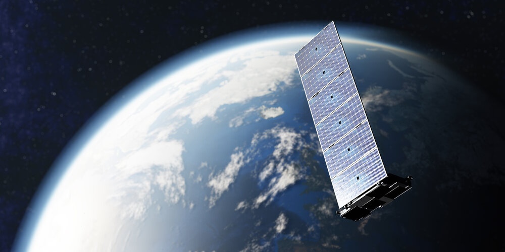
Satellite-controlled irrigation systems have been in use for several decades. To the layman, the term "satellite controller" might conjure visions of a satellite orbiting the Earth and beaming down signals that operate irrigation systems from outer space. However, that is slightly misleading.
Satellites are used to send data. This data (such as localised weather forecasting) is then used in the irrigation programming process, along with other hardware and software (sensors, etc.), to calculate the required amount of irrigation and fertigation needed.
Networked Satellite Controllers
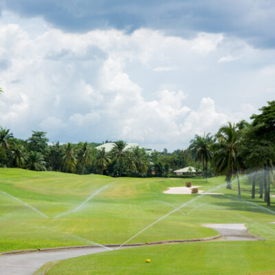
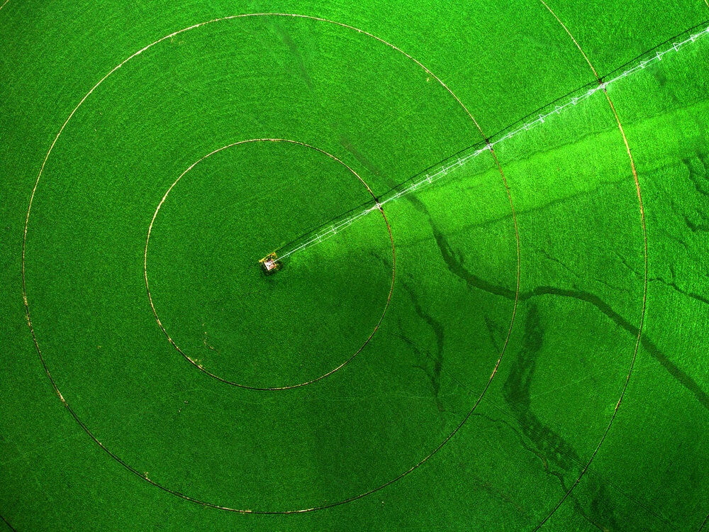
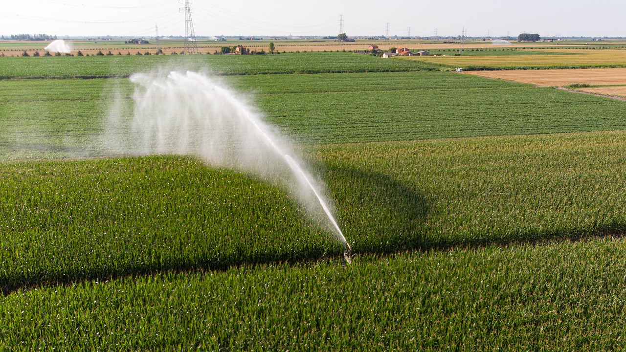
Large irrigation systems, the types used on golf courses and farms, are spread across large areas, and these systems use satellite controllers, as relay stations. These controllers are remotely located, electrically powered boxes that are each capable of operating a number of sprinklers in their individual areas. They manage when to switch the water supply on and off and how much to deliver.
Depending on the size of the local irrigation area, one or more satellite controllers can be installed. Rather than each one being operated individually, the satellite controller network is linked back to a central computer. It is this central control computer that manages each satellite and, using things like soil moisture, nutrition levels and weather forecasts, that then orders each satellite to provide the appropriate amount of irrigation or fertigation.
The Use of NASA Imagery for Satellite-Controlled Irrigation Systems
While data from satellites in orbit has been used for decades, modern technology and innovation has resulted in huge sophistication. In California, USA, state-of-the-art satellite imagery has helped farmers to halve their use of irrigation water while, at the same time, improving crop quality and yield.
One of the companies driving this new technology is Tule Technologies, and it is doing it with the help of NASA imagery via the GOES (Geostationary Operational Environmental Satellites) and Landsat satellites.
The company's founder, Tom Shapland, was surprised to discover that many farmers had little idea of how much irrigation water their crops needed. Finding out, however, was not as straightforward as he at first thought it would be.
One method that is commonly used in the irrigation industry is to calculate evapotranspiration (ET). ET covers the rate at which water evaporates from the ground and transpires from plants, and is taken back into the atmosphere. You can read more about evapotranspiration on the opnndata.org website.
Another method of establishing how much water plants lose measured by weight, is to use a lysimeter. However, from a commercial farming point of view, the use of a lysimeter is not only prohibitively expensive but is also not practical on a large scale.
Improving the Accuracy and Error Margin of Satellite Weather Data
Using satellite imagery to determine ET was an option and one commonly used, but it carries large margins of error. To remedy this, Tule Technologies came up with their surface energy balance solution. It measures energy radiated into a field from the Sun versus the energy coming off the field. By measuring the energy that is absorbed into the land, and the warmth of the air, the amount of energy used to vaporise water can be calculated and extrapolated to determine the quantity of water that is vaporised.
To significantly reduce the large margin of error, Tule then takes account of the role the wind plays. But this "mean flow" of wind doesn't allow for what is referred to as the turbulent flow of the air across the field as eddies are created, These eddies then, in turn, create new eddies as they come into contact with the land, heat and vapour.
By installing sensors with enhanced temperature sensitivity into the soil, it provides an input into the energy balance equation giving a more precise reading for heat resulting in vaporisation. So, while Tule’s solution relies heavily on satellite imagery, it doesn’t do so exclusively.
They use infra-red imagery from NASA’s geostationary operational environment satellites (GOES), which the National Oceanic and Atmospheric Administration operates. As these satellites are stationary in relation to the land below, they provide short-wave radiation measurements every five minutes or so.
In addition to this "downward" measurement, the radiation that bounces back up from the land is captured by the Landsat satellites. These satellites, built by NASA and managed by both the Space Agency and the US Geological Survey, provide fresh images every eight days. They’ve been in use since the 1970s.
Early Success Stories in California, USA
At present, Tule’s customers are all based in California. One grower of almonds has been able to redirect 25,000 gallons of water during the early stage of the growing season from an area that was being over-irrigated, to areas needing more irrigation, significantly boosting crop yield while still using the same volume of water.
Another of their customers (a vineyard) was able to save 50,000 gallons of irrigation per acre across its 100-acre site.
The amazing thing is that this type of NASA satellite imagery is available to the public at no cost.
Satellite-Driven Irrigation in Asia
In Asia, most renewable water is used in the irrigation industry. Unfortunately, due to climate change and the increasing scarcity of water, versus the need for further expansion of vital irrigation systems, the gap between the supply and demand of water is widening.
There is an urgent need to measure water flow in the irrigation canals, how much groundwater is being pumped, soil moisture and water consummation. But as the total of irrigated land is some 300 million hectares, it is simply not practical to install the number of flow meters and moisture sensors that would be needed.
The answer is an Earth observation data system.
Bearing in mind that satellite data is freely available and given the recent advance in things like computer algorithms and Cloud computing, the design of affordable irrigation monitoring systems is now a feasible proposition. Virtual field sensors can be created and installed to assist farmers to save water, lower costs and increase crop production and yield.
Drones can be used to overfly the areas to confirm satellite imagery.
The ADB (Asian Development Bank) has adopted a mobile app known as Irriwatch to help with managing irrigation for various crops, including corn, potatoes, and sugar beet.
The app works by providing local farmers with information on a nightly basis. It advises them which crops irrigating in the next 24 hours. It also updates farmers with soil moisture content and what volume of water needs to be applied.
In addition, it provides farmers daily with data regarding how much water has been delivered and consumed, and crop growth during the preceding day so that farmers can keep close tabs on irrigation efficiency and performance. It also enables crop growers to observe each field's requirements for improved efficiency and irrigation productivity.
System control panels are shared by farmers and irrigation professionals, and the careless use of limited water supplies can be monitored and detected. The information is also shared with irrigation advisory service providers as well as farmers as a way of promoting transparency,
The Irriwatch app can be downloaded at no cost from both Google PlayStore and the Apple AppStore.
Satellite-Driven Irrigation in Europe
Closer to home, here in the UK, satellite technology is also coming into the picture to help the agriculture sector in terms of improving efficiency increasing crop yields and reducing wastage. One of the problems that UK farmers face is the unpredictability of the weather.
Satellite technology can be used not only to forecast current weather but to make more accurate longer-term predictions. This can enlighten farmers with what to grow and when to grow it which will lead to optimising crop yields and reducing wastage. This will, in turn, warn farmers as to their needs in terms of future irrigation and fertilisation.
Satellite Technology Enabling Robo Tractors Enabled via Satellite Technology
Another advantage of making use of satellite data is being able to automate tractors. In Europe, EGNOS (European Geostationary Navigation Overlay Service) is being used in conjunction with GNSS (Global Navigation Satellite Systems) to improve the accurate positioning of irrigation systems.
It is a well-known fact that different microclimates exist across vast networks of fields. This technology can be harnessed to deliver the right amount of irrigation depending on crop types and local conditions.
Such improved accuracies can also be used to calculate optimal routes along which tractors can be piloted remotely. It will not only reduce labour but help with fuel economy. The benefits are enormous.
Satellite Controlled Irrigation for the UK Home Gardener
As well as the agricultural and farming sector, smart irrigation controllers are available for the home gardener. Hydrawise, Cloud Based software for Wi-Fi-based irrigation controllers designed, manufactured and sold by Australian-founded manufacturers, Hunter Industries, uses cutting-edge technology, connecting for weather updates to Weather Underground.
The Hunter HC Hydrawise Wi-Fi-enabled irrigation controller controls and monitors your home sprinkler system from anywhere in the world via your web browser or the Hydrawise iPhone or Android apps.